
Walk a Janesville Street by Address
Street research in Janesville begins with a physical location, not a person's name. The city assessor can tie that location to a tax-map number, legal description, current assessed owner, property-card pages, tax bills, and some permit records. Those facts establish the parcel. They do not prove who sleeps there now. A deed names parties to a recorded transfer, while MyVote may return public registration information linked to an address. Older directories and newspapers add household clues for earlier years.
Keep a working row for each house number. Record the date of every search, since the city is conducting a 2027 revaluation and current values can change. For a long street, finish one parcel before moving to the next. That reduces the risk of carrying an owner name or legal description into the wrong property.
- Enter the house number in both range boxes of the City of Janesville eGov search, then use the database spelling of the street.
- Open the property card and save the tax-map number, legal description, assessed owner, value year, and page reference.
- Compare the parcel in city GIS with its neighbors, alleys, streets, aerial layer, ward, zoning, floodplain, and historic district layers.
- Use the owner and legal description in the Rock County deed index. The recorder cannot search by address or parcel number.
- Check public MyVote address results, permits, old directories, atlases, and newspapers, while treating each as a dated clue rather than a household census.
This order gives the street directory a sound chain: address to parcel, parcel to owner, owner to recorded instrument, and then household evidence. When the goal becomes one historical address, continue with the Janesville past residents trail.
Janesville eGov Street Search Fields
The city's eGov instructions give a precise way to search one property. Put the same house number in House No From and House No To. Leave directional and street-type words out of the street field, and match the spelling stored by the database. For a site with several addresses, the city suggests trying the lowest number. A tax-map number from a bill is the backup when the street entry fails.
| eGov control | Entry | Purpose |
|---|---|---|
| House No From | Target number | Start of the address range |
| House No To | Same target number | Limits the result to one property |
| Street | Database spelling | Matches the property location without suffix or directional |
| Tax Map Number | Exact identifier | Alternate route when a street search fails |
| Pages / Go to Last Page | Page 3 | Reaches the detailed property record card |
The Janesville eGov property portal offers Property Location and Tax Map Number paths. Its card may include building facts, assessment values, tax bills, and permit references. Always retain the card page and assessment year.
The official eGov opening screen shows how Janesville divides the two search routes:
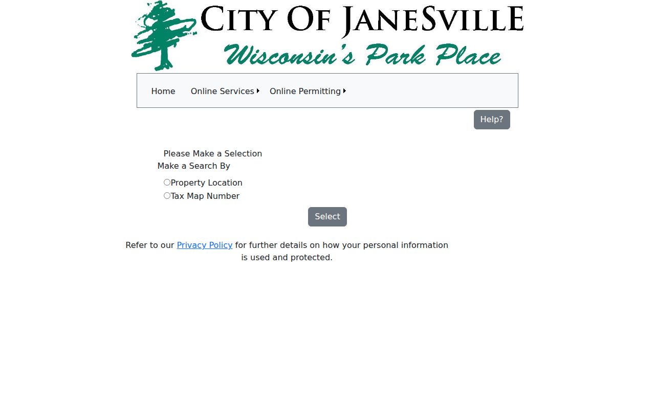
The screen confirms that a property location and a tax-map number are separate ways into the same city record system.
Janesville Address Terms That Matter
Several record terms look alike but answer different questions. Define them before building a street table, especially when an owner gets mail somewhere other than the property.
- Parcel
- A mapped unit of land used for assessment and tax records. One building can involve more than one parcel.
- Situs address
- The physical location of the property. It is not necessarily the owner's mailing address.
- Plat
- A recorded map that lays out lots, blocks, streets, and other land divisions.
- Criss-cross directory
- A directory arranged by address or street rather than surname. No separate Janesville reverse-directory run was confirmed, so ask the library before assuming one exists.
Legal descriptions carry more weight than casual street labels in deed research. They may refer to subdivision, lot and block, a certified survey map, section-town-range, or metes-and-bounds text. Copy the wording exactly.
Janesville Street Directory Record Layers
Not every source accepts a street address directly. Janesville eGov and MyVote do. GIS may support address or parcel browsing, though its exact live controls were not verified in the research. The recorder requires a name, document number, book and page, or legal description. This coverage table keeps direct searches apart from records reached by conversion.
| Record Set | Keeper | What It Shows | Access |
|---|---|---|---|
| Property card and tax bill | City Assessor | Situs, assessed owner, legal description, values, tax and some permit details | eGov, office, or phone |
| Parcel and map layers | City Maps & GIS | Parcel context, aerials, wards, zoning, floodplain, historic districts | Map library, Planning, or map request |
| Recorded instruments | Rock County Register of Deeds | Grantor, grantee, instrument type, dates, document number, legal description | Laredo/Tapestry, public terminal, counter, request |
| Voter information | MyVote and election clerks | Public registration linked to a complete address, with protected records omitted | Online, clerk, or records request |
| Permits and code files | City Building and records custodians | Work dates and applicants where public, not proof of occupancy | eGov references, office, NextRequest |
Rock County's Real Property Lister is not the municipal listing office for Janesville or Beloit. That is a crucial local split. Start with the city for a Janesville parcel, use the county tax database for tax history, and send title or chain questions to the Register of Deeds. County Land Information coordinates broader GIS work but directs Janesville parcel support back to the city.
The Rock County Tax Database Search supplies a separate view of parcel, current-tax, and historic tax information:
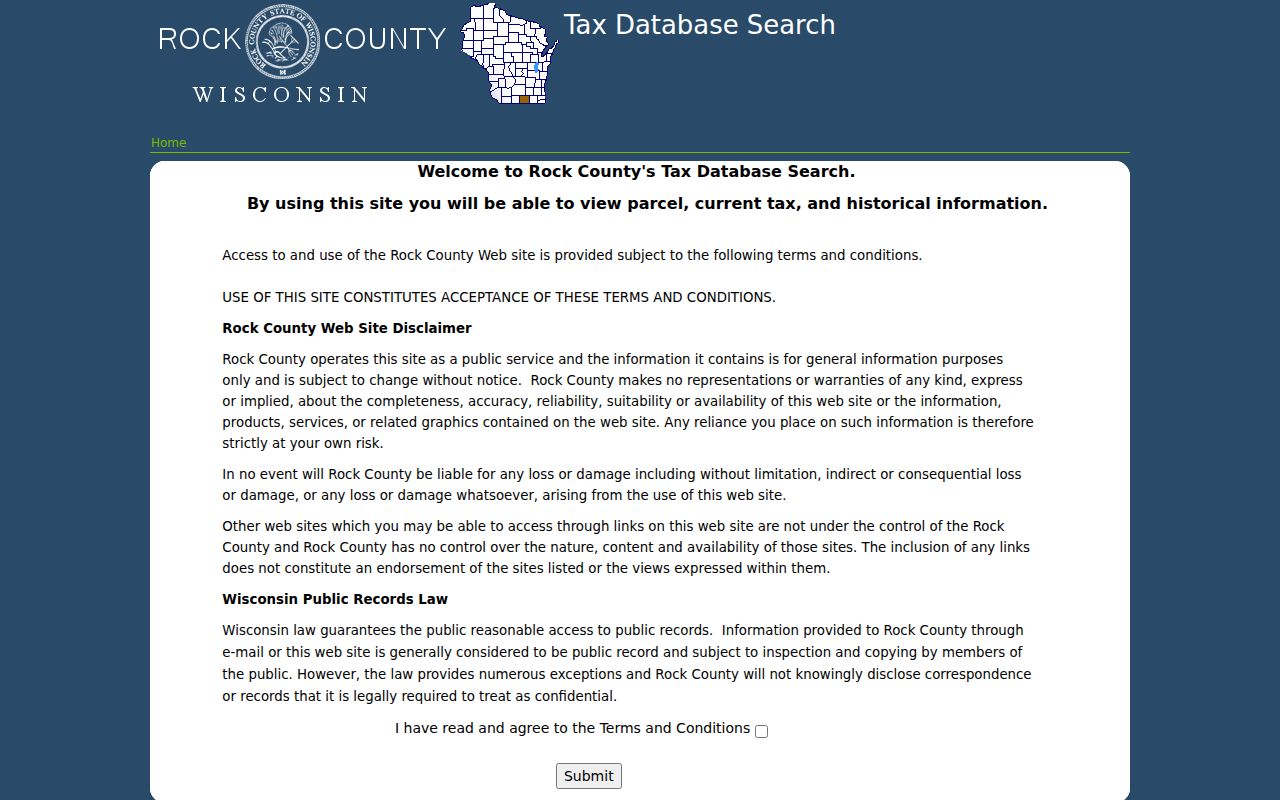
The tax screen is useful after the city property card identifies the parcel, but its tax history should not be treated as a substitute for the recorded deed image.
Note: An assessed owner is not proof that the owner lives at the situs address, and a permit date is not an occupancy date.
Map Janesville Streets with GIS
The City of Janesville Maps and GIS library brings parcel context together with zoning, polling places, wards, trails, historic districts, and floodplain material. Planning also identifies aerial photographs for 1956, 1963, 1970, 1975, 1980, 1985, 1990, 1996, and 2000. Those dated views can show when a structure or street pattern appears. They cannot name everyone who lived there.
Use GIS to click the subject parcel and the parcels beside it, then save parcel identifiers, visible situs addresses, alleys, street centerlines, layer dates, and any links to the assessed owner. The city's GIS disclaimer says parcel mapping serves tax and real-property listing needs and is not a survey. A railroad, river, alley, or access strip can make a nearby building look adjacent when the legal parcels say otherwise.
For a certified boundary or ownership question, inspect the deed, plat, or certified survey map. Planning can also print maps and help with aerial, topographic, zoning, and floodplain material when the interactive viewer does not expose the needed layer.
Convert Janesville Addresses into Deeds
The Rock County recorded-real-estate search has no address or parcel/PIN field. That missing field is the key street directory quirk. First obtain the owner and legal description from Janesville eGov, then search Laredo or Tapestry by party, document number, volume and page, or legal description. Most real-estate records have a document-number path from 1830 to the present. Grantor/grantee and document-type indexing reaches 1956 forward, while legal-description indexing reaches 1978 forward.
For subdivision searching in Laredo, enter the first five characters, choose Look up, select the subdivision, and add lot and block. The county says lot ranges do not work. For unplatted land, use section, town, range, quarter, and quarter-quarter controls. Platted land needs its current legal description. Search both a quick party-name path and an advanced legal-description path because the working index may contain omissions.
Tapestry costs $8.75 per search and $1 per printed image. Courthouse public terminals provide Laredo access without that online search charge, although copy fees still apply. Official copies are $2 for the first page and $1 for each added page, plus $1 for certification. Walk-in help, the lobby drop box, phone, fax, and written requests provide fallback channels.
Check Janesville Voters by Address
MyVote Wisconsin accepts a complete street address, unit when applicable, city, and ZIP. Its public result may show registration status, elections voted, absentee activity, elected officials, and tracking information. It does not show ballot choices. A public poll book can contain a name, address, photo-ID indication, and signature under clerk procedures, but MyVote is not a full list of every person in a house or along a block.
When there is no match, confirm the exact city and ZIP and then contact the Janesville Clerk-Treasurer at 608-755-3070. Voter activity older than ten years takes a separate Badger Voters request. Protected information is omitted, and local poll-list copies can be subject to reproduction rules. Cite the search date and describe only records actually returned.
Note: The City of Janesville, Rock County, wards, and ZIP delivery areas use different boundaries, so do not treat one as the other.
Older Janesville Streets Need Crosswalks
Early Janesville sources may describe a place by the Rock River, a mill, bridge, ward, plat, post office, or business landmark. Permanent settlement began in 1835, the county seat developed in 1836 and 1837, and the city incorporated in 1853. Modern house numbers cannot safely be projected back across that whole span.
No official street-renumbering, annexation, or address-conversion chronology was confirmed. Do not assign a renumbering year. Instead, compare the 1862 Bailey directory, the 1873 Combination Atlas, the 1913 Wright directory, old plats, historic-district material, city maps, newspapers, and dated aerials. The Wisconsin Sanborn map collection contains 901 maps and 7,720 page images across 251 communities, mostly from the 1880s through 1930s, but Janesville's exact available years were not established.
The 1873 atlas can bridge an owner name to a drawn house, farm, or business when no modern number appears. Historical volumes themselves belong to the Janesville city directories collection; use them here only to translate an old place into a present parcel.
Janesville Street Records Beyond Portals
Online access is only one route. The City Assessor at 18 N. Jackson Street can help with cards and assessment questions at 608-755-3045. Planning and GIS handle city map layers, while Building and the city's NextRequest portal provide routes for permits, addressing files, and administrative records that are not posted. Wisconsin Public Records Law, Wis. Stat. §§19.31–19.39, supports specific requests to the right custodian.
At the Rock County Courthouse, 51 S. Main Street, the Register of Deeds offers walk-in service and public terminals from 8:00 a.m. to 4:30 p.m. on weekdays. Hedberg Public Library's Wisconsin Room adds atlases, directories, newspapers, maps, photographs, and yearbooks. State and university archives can fill older gaps. Phone, mail, fax, drop-box, reference, and reproduction requests matter when a portal lacks an image or usable index.
Limits of a Janesville Street Directory
A parcel card identifies assessed ownership, not every occupant. Recorded deeds identify parties to instruments, not a live household. Voter records omit people who are not registered and protect some addresses. Permits document work, not the dates someone moved in or out. Old directories can miss people, lag a move, abbreviate a name, or use a former address system.
Wisconsin Safe at Home assigns a substitute address to eligible participants. Confidential-elector rules can also keep an actual or last-known address from ordinary handling. A missing result must never be treated as proof that a person does not live in Janesville. Commercial people-finder data is also prone to stale and merged identities; official source dates and document images are safer reference points.
Lawful use. Use Janesville address records only for lawful personal research. Never use them to stalk, harass, intimidate, or harm a person.
The strongest street directory result is modest and dated: a parcel owner, a recorded transfer, a publicly returned registration clue, or a historical citation. Keep those labels intact.